
Thank you for supporting this site ❤️
Make a donation
Make a donation
Gear up for your next adventure:
As an Amazon Associate, this site earns from qualifying purchases at no extra cost to you.
Bietschhorn topographic map
Click on the map to display elevation.
Thank you for supporting this site ❤️
Make a donation
Make a donation
Gear up for your next adventure:
As an Amazon Associate, this site earns from qualifying purchases at no extra cost to you.
About this map
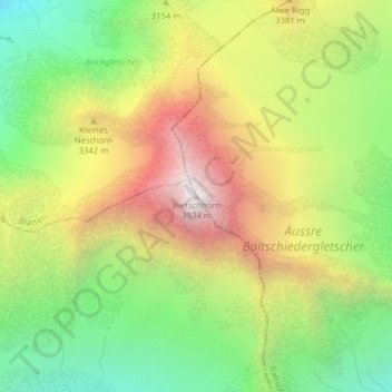
Name: Bietschhorn topographic map, elevation, terrain.
Location: Bietschhorn, Baltschieder, Visp, Wallis, 3937, Schweiz (46.39152 7.85077 46.39162 7.85087)
Average elevation: 10,138 ft
Minimum elevation: 7,907 ft
Maximum elevation: 12,822 ft
Thank you for supporting this site ❤️
Make a donation
Make a donation
Gear up for your next adventure:
As an Amazon Associate, this site earns from qualifying purchases at no extra cost to you.