Geolocate

Llanelli topographic map

Click on the map to display elevation.

About this map

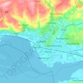
Name: Llanelli topographic map, elevation, terrain.

Location: Llanelli, Carmarthenshire, Wales, SA15 1SA, United Kingdom (51.63973 -4.20202 51.71973 -4.12202)

Average elevation: 135 ft

Minimum elevation: -10 ft

Maximum elevation: 623 ft

Gear up for your next adventure:

🌲Outdoor Survival Books - Best books on survival skills
🔋Solar Power Banks - Keep your GPS and phone charged in remote wilderness areas
Solar GPS Watches - Advanced multisport watches with built-in topographic maps
🧥Waterproof Jacket for Hiking - Breathable and rugged rain jacket for outdoor excursions
🪓Survival Multi‑Tool - Versatile tool for camp and trail tasks

As an Amazon Associate, this site earns from qualifying purchases at no extra cost to you.