Geolocate

Moravia topographic map

Click on the map to display elevation.

About this map

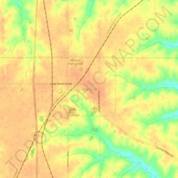
Name: Moravia topographic map, elevation, terrain.

Location: Moravia, Appanoose County, Iowa, 52571, United States (40.87118 -92.83450 40.91118 -92.79450)

Average elevation: 978 ft

Minimum elevation: 889 ft

Maximum elevation: 1,010 ft

Gear up for your next adventure:

🪵Folding Camp Saw - Compact saw for wood and campsite work
📡GPS Antenna Upgrade - Enhance GPS reception in remote terrain
🕶️Glacier Sunglasses - Side shields to protect eyes from high-altitude snow glare
🛠️Backpacking Tool Kit - Essential toolkit for outdoor repairs
🎒Gear Packing Cubes - Organize your backpack efficiently

As an Amazon Associate, this site earns from qualifying purchases at no extra cost to you.