
Thank you for supporting this site ❤️
Make a donation
Make a donation
Gear up for your next adventure:
As an Amazon Associate, this site earns from qualifying purchases at no extra cost to you.
Blackbutt topographic map
Click on the map to display elevation.
Thank you for supporting this site ❤️
Make a donation
Make a donation
Gear up for your next adventure:
As an Amazon Associate, this site earns from qualifying purchases at no extra cost to you.
About this map
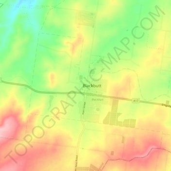
Name: Blackbutt topographic map, elevation, terrain.
Location: Blackbutt, South Burnett Regional, Queensland, Australia (-26.89745 152.08373 -26.86863 152.13581)
Average elevation: 1,476 ft
Minimum elevation: 1,181 ft
Maximum elevation: 1,739 ft
Thank you for supporting this site ❤️
Make a donation
Make a donation
Gear up for your next adventure:
As an Amazon Associate, this site earns from qualifying purchases at no extra cost to you.