Geolocate

Pequea topographic map

Click on the map to display elevation.

About this map

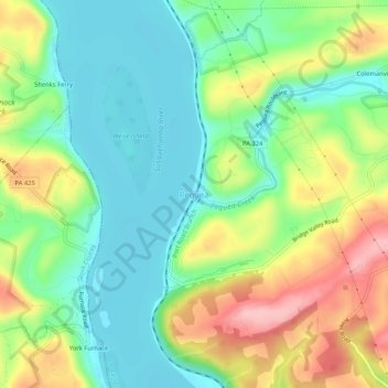
Name: Pequea topographic map, elevation, terrain.

Location: Pequea, Lancaster County, Pennsylvania, 17585, United States (39.86816 -76.38718 39.90816 -76.34718)

Average elevation: 358 ft

Minimum elevation: 164 ft

Maximum elevation: 689 ft

Lancaster County trails, hiking, mountain biking, running and outdoor activities

Gear up for your next adventure:

🧭Orienteering Set - Complete compass and map reading kit
📦Dry Bags Set - Waterproof storage for electronics and clothes
🔭Telescopic Hiking Pole - Adjustable pole for hiking stability
🌎3D Topographic Globes - Raised relief globes for a tactile understanding of geography
📷Action Camera - Capture your outdoor adventures in HD

As an Amazon Associate, this site earns from qualifying purchases at no extra cost to you.