Geolocate

Conehatta topographic map

Click on the map to display elevation.

About this map

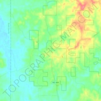
Name: Conehatta topographic map, elevation, terrain.

Location: Conehatta, Newton County, Mississippi, United States (32.41583 -89.32253 32.49481 -89.23614)

Average elevation: 443 ft

Minimum elevation: 354 ft

Maximum elevation: 627 ft

Newton County trails, hiking, mountain biking, running and outdoor activities

Gear up for your next adventure:

📚Navigation Handbooks - Master the art of reading topographic maps and using a compass
📚USA Hiking Guide Books - Top trail guides and map books
🕶️Glacier Sunglasses - Side shields to protect eyes from high-altitude snow glare
🔊Portable Camp Speaker - Music and alerts at camp
🪑Ultralight Camp Chairs - Portable seating for resting after a long day of mapping

As an Amazon Associate, this site earns from qualifying purchases at no extra cost to you.