
Thank you for supporting this site ❤️
Make a donation
Make a donation
Gear up for your next adventure:
As an Amazon Associate, this site earns from qualifying purchases at no extra cost to you.
Chassepierre topographic map
Click on the map to display elevation.
Thank you for supporting this site ❤️
Make a donation
Make a donation
Gear up for your next adventure:
As an Amazon Associate, this site earns from qualifying purchases at no extra cost to you.
About this map
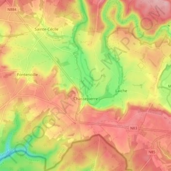
Name: Chassepierre topographic map, elevation, terrain.
Location: Chassepierre, Florenville, Virton, Luxemburg, Wallonië, België (49.68537 5.22938 49.73797 5.30827)
Average elevation: 1,056 ft
Minimum elevation: 758 ft
Maximum elevation: 1,266 ft
Thank you for supporting this site ❤️
Make a donation
Make a donation
Gear up for your next adventure:
As an Amazon Associate, this site earns from qualifying purchases at no extra cost to you.