
Clayton topographic map
Click on the map to display elevation.
Clayton
According to the United States Census Bureau, the city has a total area of 3.1 square miles (8.0 km2), all of it land. The elevation of Clayton's downtown area is 1,925 feet (587 m). A number of hilltops within the city limits exceed 2,200 feet.
About this map
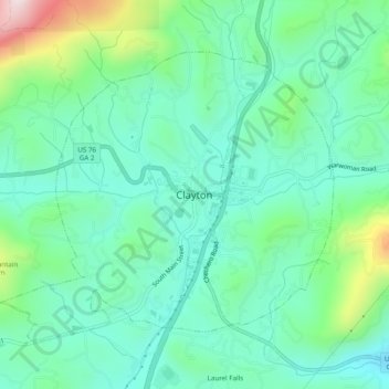
Name: Clayton topographic map, elevation, terrain.
Location: Clayton, Rabun County, Georgia, 30525, United States (34.85815 -83.42099 34.89815 -83.38099)
Average elevation: 2,080 ft
Minimum elevation: 1,670 ft
Maximum elevation: 3,327 ft