Geolocate

Cardston (town) topographic map

Click on the map to display elevation.

About this map

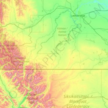
Name: Cardston (town) topographic map, elevation, terrain.

Location: Cardston (town), Alberta, T0K 0K0, Canada (48.49307 -114.00930 49.89307 -112.60930)

Average elevation: 4,285 ft

Minimum elevation: 2,484 ft

Maximum elevation: 10,285 ft

Gear up for your next adventure:

🪑Ultralight Camp Chairs - Portable seating for resting after a long day of mapping
📷Action Camera - Capture your outdoor adventures in HD
🔥Plasma Lighters - Windproof lighters that work in any weather condition
🎁Geography Themed Gifts - Unique gift ideas for map lovers and geography enthusiasts
🛡️Bear Spray Outdoor - Protection in bear country hikes

As an Amazon Associate, this site earns from qualifying purchases at no extra cost to you.