Geolocate

Ybel topographic map

Click on the map to display elevation.

About this map

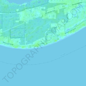
Name: Ybel topographic map, elevation, terrain.

Location: Ybel, Sanibel, Lee County, Florida, 33957, United States (26.40453 -82.09093 26.44453 -82.05093)

Average elevation: 7 ft

Minimum elevation: -3 ft

Maximum elevation: 33 ft

Lee County trails, hiking, mountain biking, running and outdoor activities

Other topographic maps

Click on a map to view its topography, its elevation and its terrain.

Blind Pass Beach

United States > Florida > Lee County > Sanibel > Wulfert

Average elevation: 3 ft

Gear up for your next adventure:

🔌Solar Panel Charger - Charge gear sustainably outdoors
🥾Men's Hiking Boots - Durable, waterproof footwear for rugged terrain and steep inclines
🚁Photography Drones - Capture stunning aerial views of landforms and topography
📚Navigation Handbooks - Master the art of reading topographic maps and using a compass
🥩Freeze-Dried Meals - Nutritious and lightweight food for remote expeditions

As an Amazon Associate, this site earns from qualifying purchases at no extra cost to you.