
Thank you for supporting this site ❤️
Make a donation
Make a donation
Gear up for your next adventure:
As an Amazon Associate, this site earns from qualifying purchases at no extra cost to you.
Mollendo topographic map
Click on the map to display elevation.
Thank you for supporting this site ❤️
Make a donation
Make a donation
Gear up for your next adventure:
As an Amazon Associate, this site earns from qualifying purchases at no extra cost to you.
About this map
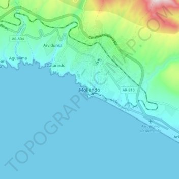
Name: Mollendo topographic map, elevation, terrain.
Location: Mollendo, Province of Islay, Arequipa, 04416, Peru (-17.06925 -72.05554 -16.98925 -71.97554)
Average elevation: 328 ft
Minimum elevation: -3 ft
Maximum elevation: 2,346 ft
Thank you for supporting this site ❤️
Make a donation
Make a donation
Gear up for your next adventure:
As an Amazon Associate, this site earns from qualifying purchases at no extra cost to you.