Geolocate

Mollendo topographic map

Click on the map to display elevation.

About this map

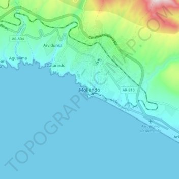
Name: Mollendo topographic map, elevation, terrain.

Location: Mollendo, Province of Islay, Arequipa, 04416, Peru (-17.06925 -72.05554 -16.98925 -71.97554)

Average elevation: 328 ft

Minimum elevation: -3 ft

Maximum elevation: 2,346 ft

Gear up for your next adventure:

🛏️Cold Weather Sleeping Bag - Warm sleeping bag for cold conditions
🧭Outdoor Navigation Book - Learn advanced navigation skills
🏔️Mountain Trail Maps - High‑detail maps for popular peaks
🏥Hiking First Aid Kits - Comprehensive medical kits for remote trail injuries
🌎3D Topographic Globes - Raised relief globes for a tactile understanding of geography

As an Amazon Associate, this site earns from qualifying purchases at no extra cost to you.