
Thank you for supporting this site ❤️
Make a donation
Make a donation
Gear up for your next adventure:
As an Amazon Associate, this site earns from qualifying purchases at no extra cost to you.
Kampl topographic map
Click on the map to display elevation.
Thank you for supporting this site ❤️
Make a donation
Make a donation
Gear up for your next adventure:
As an Amazon Associate, this site earns from qualifying purchases at no extra cost to you.
About this map
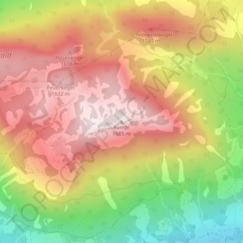
Name: Kampl topographic map, elevation, terrain.
Location: Kampl, Bad Mitterndorf, Bezirk Liezen, Styrie, 8983, Autriche (47.58883 13.87700 47.58893 13.87710)
Average elevation: 4,403 ft
Minimum elevation: 2,969 ft
Maximum elevation: 5,502 ft
Thank you for supporting this site ❤️
Make a donation
Make a donation
Gear up for your next adventure:
As an Amazon Associate, this site earns from qualifying purchases at no extra cost to you.