
Thank you for supporting this site ❤️
Make a donation
Make a donation
Gear up for your next adventure:
As an Amazon Associate, this site earns from qualifying purchases at no extra cost to you.
Limulunga topographic map
Click on the map to display elevation.
Thank you for supporting this site ❤️
Make a donation
Make a donation
Gear up for your next adventure:
As an Amazon Associate, this site earns from qualifying purchases at no extra cost to you.
About this map
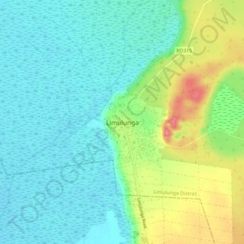
Name: Limulunga topographic map, elevation, terrain.
Location: Limulunga, Limulunga District, Western Province, Zambia (-15.16919 23.10755 -15.08919 23.18755)
Average elevation: 3,402 ft
Minimum elevation: 3,330 ft
Maximum elevation: 3,602 ft
Thank you for supporting this site ❤️
Make a donation
Make a donation
Gear up for your next adventure:
As an Amazon Associate, this site earns from qualifying purchases at no extra cost to you.