Geolocate

Ugha topographic map

Click on the map to display elevation.

About this map

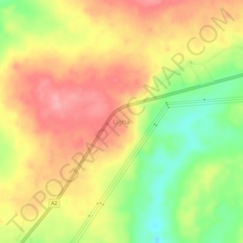
Name: Ugha topographic map, elevation, terrain.

Location: Ugha, Uhunmwonde, Edo State, Nigeria (6.54687 5.87415 6.58687 5.91415)

Average elevation: 538 ft

Minimum elevation: 338 ft

Maximum elevation: 689 ft

Gear up for your next adventure:

🏥Hiking First Aid Kits - Comprehensive medical kits for remote trail injuries
🎒Gear Packing Cubes - Organize your backpack efficiently
🛠️Outdoor Gear Repair Kit - Essential tools to fix gear on the trail
🦶Carbon Trekking Poles - Reduce knee impact on steep descents with ultra-light poles
🧢Sun Protection Hats - Wide-brimmed and UPF-rated hats for high-altitude sun safety

As an Amazon Associate, this site earns from qualifying purchases at no extra cost to you.