
Kemasik topographic map
Click on the map to display elevation.
About this map
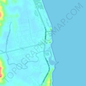
Name: Kemasik topographic map, elevation, terrain.
Location: Kemasik, Kemaman District, Terengganu, 24200, Malaysia (4.40679 103.43120 4.44679 103.47120)
Average elevation: 20 ft
Minimum elevation: -7 ft
Maximum elevation: 338 ft
Other topographic maps
Click on a map to view its topography, its elevation and its terrain.
Stadium Mini Mak Chili
Malaysia > Terengganu > Kemaman District > Kampung Kaya
Average elevation: 23 ft
Sungai Kandang Rusa
Malaysia > Terengganu > Kemaman District > Kampung Semayor
Average elevation: 105 ft