Geolocate

Dunga topographic map

Click on the map to display elevation.

About this map

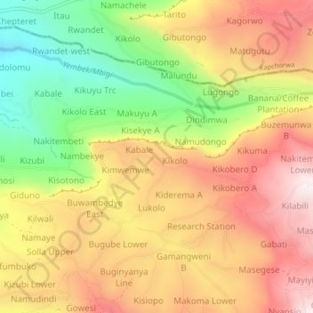
Name: Dunga topographic map, elevation, terrain.

Location: Dunga, Bugisa sub-region, Bulambuli, Eastern Region, Uganda (1.26858 34.34860 1.30858 34.38860)

Average elevation: 5,919 ft

Minimum elevation: 4,587 ft

Maximum elevation: 7,077 ft

Gear up for your next adventure:

🧦Merino Wool Socks - Moisture-wicking, blister-preventing socks for long treks
🏫Relief Map Kits - Hands-on tools for teaching landforms and elevation
🥾Men's Hiking Boots - Durable, waterproof footwear for rugged terrain and steep inclines
📌Outdoor GPS Map App - Apps and devices for digital topographic navigation
🥤Water Filter Bottle - All‑in‑one filter bottle for safe hydration

As an Amazon Associate, this site earns from qualifying purchases at no extra cost to you.