Geolocate

dhanaula topographic map

Click on the map to display elevation.

About this map

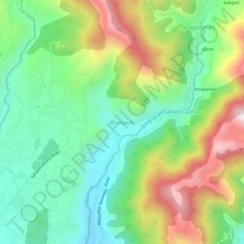
Name: dhanaula topographic map, elevation, terrain.

Location: dhanaula, Dehradun, Uttarakhand, 248013, India (30.36354 78.09807 30.40354 78.13807)

Average elevation: 3,317 ft

Minimum elevation: 2,464 ft

Maximum elevation: 4,760 ft

Gear up for your next adventure:

🧤Hiking Gloves - Protective gloves for rugged trails
🧢Outdoor Hiking Hat - Sun protection hat for outdoor explorers
👓Polarized Sunglasses - Outdoor sunglasses for glare reduction
Backpacking Tent - Lightweight and durable tent for multi‑day hikes
🩳Quick‑Dry Hiking Shorts - Comfortable and quick‑dry shorts for summer hiking

As an Amazon Associate, this site earns from qualifying purchases at no extra cost to you.