
Thank you for supporting this site ❤️
Make a donation
Make a donation
Gear up for your next adventure:
As an Amazon Associate, this site earns from qualifying purchases at no extra cost to you.
Salanpur topographic map
Click on the map to display elevation.
Thank you for supporting this site ❤️
Make a donation
Make a donation
Gear up for your next adventure:
As an Amazon Associate, this site earns from qualifying purchases at no extra cost to you.
About this map
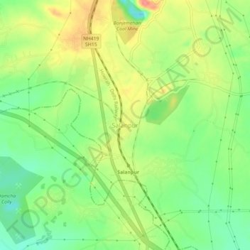
Name: Salanpur topographic map, elevation, terrain.
Location: Salanpur, Paschim Bardhaman, West Bengal, 713369, India (23.74797 86.85473 23.78797 86.89473)
Average elevation: 486 ft
Minimum elevation: 374 ft
Maximum elevation: 620 ft
Thank you for supporting this site ❤️
Make a donation
Make a donation
Gear up for your next adventure:
As an Amazon Associate, this site earns from qualifying purchases at no extra cost to you.