Geolocate

Wonosari topographic map

Click on the map to display elevation.

About this map

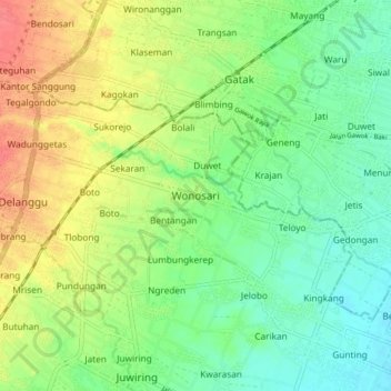
Name: Wonosari topographic map, elevation, terrain.

Location: Wonosari, Klaten, Central Java, Java, 57473, Indonesia (-7.65482 110.69594 -7.57482 110.77594)

Average elevation: 384 ft

Minimum elevation: 305 ft

Maximum elevation: 499 ft

Other topographic maps

Click on a map to view its topography, its elevation and its terrain.

Sanggrahan

Indonesia > Central Java > Klaten

Average elevation: 492 ft

Sungai

Indonesia > Central Java > Klaten > Nanggulan

Average elevation: 371 ft

Gear up for your next adventure:

🗺️Topographic Maps - Detailed topo maps for hiking, exploring and outdoor navigation
🔊Portable Camp Speaker - Music and alerts at camp
👟Trail Running Shoes - Lightweight shoes for trail runners
📦Dry Bags Set - Waterproof storage for electronics and clothes
📶Satellite Messenger - Communication device off‑grid

As an Amazon Associate, this site earns from qualifying purchases at no extra cost to you.