
Thank you for supporting this site ❤️
Make a donation
Make a donation
Gear up for your next adventure:
As an Amazon Associate, this site earns from qualifying purchases at no extra cost to you.
Sveg topographic map
Click on the map to display elevation.
Thank you for supporting this site ❤️
Make a donation
Make a donation
Gear up for your next adventure:
As an Amazon Associate, this site earns from qualifying purchases at no extra cost to you.
About this map
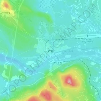
Name: Sveg topographic map, elevation, terrain.
Location: Sveg, Härjedalens kommun, Jämtland County, 842 32, Sweden (61.99607 14.31984 62.07607 14.39984)
Average elevation: 1,247 ft
Minimum elevation: 1,132 ft
Maximum elevation: 1,831 ft
Thank you for supporting this site ❤️
Make a donation
Make a donation
Gear up for your next adventure:
As an Amazon Associate, this site earns from qualifying purchases at no extra cost to you.