
Thank you for supporting this site ❤️
Make a donation
Make a donation
Gear up for your next adventure:
As an Amazon Associate, this site earns from qualifying purchases at no extra cost to you.
Chillaco topographic map
Click on the map to display elevation.
Thank you for supporting this site ❤️
Make a donation
Make a donation
Gear up for your next adventure:
As an Amazon Associate, this site earns from qualifying purchases at no extra cost to you.
About this map
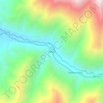
Name: Chillaco topographic map, elevation, terrain.
Location: Chillaco, Antioquía, Huarochirí, Lima, Perú (-12.05748 -76.61289 -12.01748 -76.57289)
Average elevation: 5,167 ft
Minimum elevation: 3,455 ft
Maximum elevation: 8,186 ft
Thank you for supporting this site ❤️
Make a donation
Make a donation
Gear up for your next adventure:
As an Amazon Associate, this site earns from qualifying purchases at no extra cost to you.