
Thank you for supporting this site ❤️
Make a donation
Make a donation
Gear up for your next adventure:
As an Amazon Associate, this site earns from qualifying purchases at no extra cost to you.
Ulloa topographic map
Click on the map to display elevation.
Thank you for supporting this site ❤️
Make a donation
Make a donation
Gear up for your next adventure:
As an Amazon Associate, this site earns from qualifying purchases at no extra cost to you.
About this map
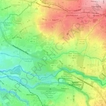
Name: Ulloa topographic map, elevation, terrain.
Location: Ulloa, Cantón Heredia, Heredia Province, 40104, Costa Rica (9.95931 -84.16241 9.99096 -84.10937)
Average elevation: 3,399 ft
Minimum elevation: 3,025 ft
Maximum elevation: 3,858 ft
Thank you for supporting this site ❤️
Make a donation
Make a donation
Gear up for your next adventure:
As an Amazon Associate, this site earns from qualifying purchases at no extra cost to you.