
Thank you for supporting this site ❤️
Make a donation
Make a donation
Gear up for your next adventure:
As an Amazon Associate, this site earns from qualifying purchases at no extra cost to you.
Fornasotto topographic map
Click on the map to display elevation.
Thank you for supporting this site ❤️
Make a donation
Make a donation
Gear up for your next adventure:
As an Amazon Associate, this site earns from qualifying purchases at no extra cost to you.
About this map
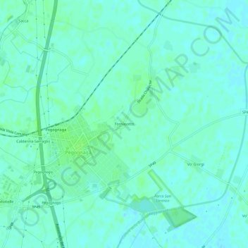
Name: Fornasotto topographic map, elevation, terrain.
Location: Fornasotto, Pegognaga, Mantova, Lombardia, Italia (44.98057 10.84930 45.02057 10.88930)
Average elevation: 59 ft
Minimum elevation: 46 ft
Maximum elevation: 72 ft
Thank you for supporting this site ❤️
Make a donation
Make a donation
Gear up for your next adventure:
As an Amazon Associate, this site earns from qualifying purchases at no extra cost to you.