
Make a donation
Gear up for your next adventure:
As an Amazon Associate, this site earns from qualifying purchases at no extra cost to you.
Hertefeld topographic map
Click on the map to display elevation.
Make a donation
Gear up for your next adventure:
As an Amazon Associate, this site earns from qualifying purchases at no extra cost to you.
About this map
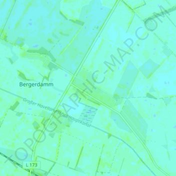
Name: Hertefeld topographic map, elevation, terrain.
Average elevation: 102 ft
Minimum elevation: 92 ft
Maximum elevation: 112 ft
Make a donation
Gear up for your next adventure:
As an Amazon Associate, this site earns from qualifying purchases at no extra cost to you.
Other topographic maps
Click on a map to view its topography, its elevation and its terrain.
Börnicke
Deutschland > Brandenburg > Havelland > Nauen
Börnicke liegt in einer Höhe von 34 m ü. NHN etwa 10 Kilometer nordöstlich von Nauen an der Bundesstraße 273 zwischen Nauen und Kremmen und ca. 4 km entfernt vom Anschluss Kremmen (AS 25) der Bundesautobahn 24. Der Ort hat eine Fläche von 19,07 km².
Average elevation: 121 ft
Tietzow
Deutschland > Brandenburg > Havelland > Nauen
Tietzow liegt in einer Höhe von 34 m ü. NHN etwa 13 Kilometer nordöstlich von Nauen nördlich der Bundesstraße 273 zwischen Nauen und Kremmen und ca. 3 km Luftlinie entfernt vom Anschluss Kremmen (AS 25) der Bundesautobahn 24. Der Ort hat eine Fläche von 17,86 km² und bei 346 Einwohnern (Stand: 31. Dez.…
Average elevation: 125 ft
Make a donation
Gear up for your next adventure:
As an Amazon Associate, this site earns from qualifying purchases at no extra cost to you.