Geolocate

Qus topographic map

Click on the map to display elevation.

About this map

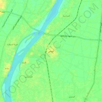
Name: Qus topographic map, elevation, terrain.

Location: Qus, Luxor, 83621, Egypt (25.87567 32.72297 25.95567 32.80297)

Average elevation: 243 ft

Minimum elevation: 213 ft

Maximum elevation: 282 ft

Other topographic maps

Click on a map to view its topography, its elevation and its terrain.

Valley of the Kings

Egypt > Luxor > New Al Qarnh City

Average elevation: 692 ft

New Karnak

Egypt > Luxor

Average elevation: 253 ft

New Al Qarnh City

Egypt > Luxor

Average elevation: 404 ft

Luxor City

Egypt > Luxor

Average elevation: 256 ft

Gear up for your next adventure:

🎒Day Hiking Backpack - Lightweight backpack perfect for day trips and outdoor adventures
🧦Hiking Socks - Comfortable socks to prevent blisters on long hikes
🧢Outdoor Hiking Hat - Sun protection hat for outdoor explorers
🪶Trail Camera - Capture wildlife on your hikes
🌡️Handheld Weather Meters - Measure wind, temp, and pressure for safe mountain travel

As an Amazon Associate, this site earns from qualifying purchases at no extra cost to you.