Geolocate

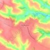
Shpola topographic map

Click on the map to display elevation.

About this map

Name: Shpola topographic map, elevation, terrain.

Location: Shpola, Шполянська міська громада, Zvenyhorodka Raion, Cherkasy Oblast, 20602, Ukraine (48.96251 31.34811 49.02652 31.42134)

Average elevation: 551 ft

Minimum elevation: 466 ft

Maximum elevation: 725 ft

Other topographic maps

Click on a map to view its topography, its elevation and its terrain.

Antonina

Ukraine > Cherkasy Oblast

Average elevation: 853 ft

Dnieper River

Ukraine > Cherkasy Oblast

The source of the Dnieper is the sedge bogs (Akseninsky Mokh) of the Valdai Hills in central Russia, at an elevation of 220 m (720 ft). For 115 km (71 mi) of its length, it serves as the border between Belarus and Ukraine. Its estuary, or liman, used to be defended by the strong fortress of Ochakiv.

Average elevation: 272 ft
Ratseve

Ukraine > Cherkasy Oblast

Average elevation: 312 ft

Kostiantynivka

Ukraine > Cherkasy Oblast

Average elevation: 404 ft

Talne

Ukraine > Cherkasy Oblast

Average elevation: 564 ft

Zhashkiv

Ukraine > Cherkasy Oblast

Average elevation: 755 ft

Impact crater

Ukraine > Cherkasy Oblast

Average elevation: 807 ft

Vodianyky

Ukraine > Cherkasy Oblast

Average elevation: 689 ft

Kheilove

Ukraine > Cherkasy Oblast

Average elevation: 761 ft

П’ятихатки

Ukraine > Cherkasy Oblast > Cherkasy

Average elevation: 315 ft

Zhurzhyntsi

Ukraine > Cherkasy Oblast

Average elevation: 719 ft

Gear up for your next adventure:

🛶Inflatable Kayak - Portable kayak for rivers, lakes, and expeditions
🚁Photography Drones - Capture stunning aerial views of landforms and topography
🧼Biodegradable Camping Soap - Eco‑friendly soap for outdoor hygiene
🥾Women's Hiking Boots - Top-rated trail boots with ankle support and superior grip
🥤Water Filter Bottle - All‑in‑one filter bottle for safe hydration

As an Amazon Associate, this site earns from qualifying purchases at no extra cost to you.