
Thank you for supporting this site ❤️
Make a donation
Make a donation
Gear up for your next adventure:
As an Amazon Associate, this site earns from qualifying purchases at no extra cost to you.
Ser topographic map
Click on the map to display elevation.
Thank you for supporting this site ❤️
Make a donation
Make a donation
Gear up for your next adventure:
As an Amazon Associate, this site earns from qualifying purchases at no extra cost to you.
About this map
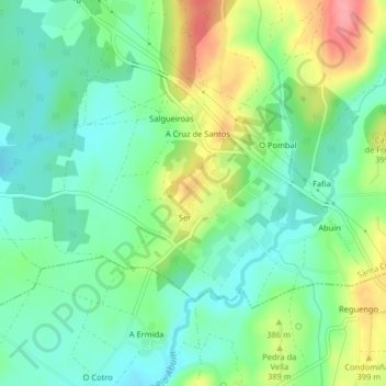
Name: Ser topographic map, elevation, terrain.
Location: Ser, Santa Comba, O Xallas, A Coruña, Galicia, Spain (43.00290 -8.80511 43.02059 -8.76465)
Average elevation: 1,194 ft
Minimum elevation: 1,086 ft
Maximum elevation: 1,398 ft
Thank you for supporting this site ❤️
Make a donation
Make a donation
Gear up for your next adventure:
As an Amazon Associate, this site earns from qualifying purchases at no extra cost to you.