
Colfax topographic map
Click on the map to display elevation.
Colfax
Colfax is located in western Grant Parish at 31°31′11″N 92°42′30″W / 31.51972°N 92.70833°W / 31.51972; -92.70833 (31.519783, -92.708446), on the northeast side of the Red River, and has an elevation of 95 feet (29.0 m) above sea level. Louisiana Highway 8 passes through the center of town, leading east 2 miles (3 km) to U.S. Route 71 and south 12 miles (19 km) to Boyce. Alexandria is 26 miles (42 km) to the southeast.
About this map
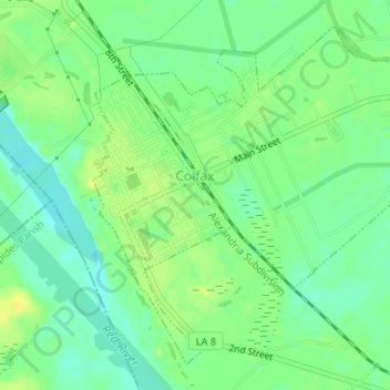
Name: Colfax topographic map, elevation, terrain.
Location: Colfax, Grant Parish, Louisiana, United States (31.50592 -92.71539 31.53011 -92.68272)
Average elevation: 92 ft
Minimum elevation: 59 ft
Maximum elevation: 128 ft
Grant Parish trails, hiking, mountain biking, running and outdoor activities
Other topographic maps
Click on a map to view its topography, its elevation and its terrain.