
Make a donation
Gear up for your next adventure:
As an Amazon Associate, this site earns from qualifying purchases at no extra cost to you.
Cement Hill topographic map
Click on the map to display elevation.
Make a donation
Gear up for your next adventure:
As an Amazon Associate, this site earns from qualifying purchases at no extra cost to you.
About this map
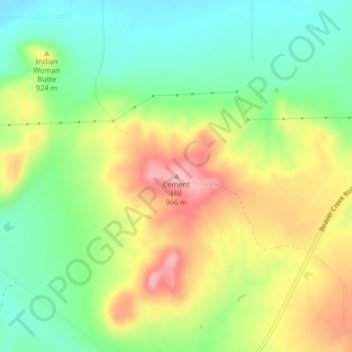
Name: Cement Hill topographic map, elevation, terrain.
Location: Cement Hill, Hill County, Montana, United States (48.49439 -109.71247 48.49449 -109.71237)
Average elevation: 2,894 ft
Minimum elevation: 2,680 ft
Maximum elevation: 3,176 ft
Hill County trails, hiking, mountain biking, running and outdoor activities
Make a donation
Gear up for your next adventure:
As an Amazon Associate, this site earns from qualifying purchases at no extra cost to you.
Other topographic maps
Click on a map to view its topography, its elevation and its terrain.
Rocky Boy's Agency
United States > Montana > Hill County > Rocky Boy's Agency
Average elevation: 3,930 ft