
Thank you for supporting this site ❤️
Make a donation
Make a donation
Gear up for your next adventure:
As an Amazon Associate, this site earns from qualifying purchases at no extra cost to you.
Lamajang topographic map
Click on the map to display elevation.
Thank you for supporting this site ❤️
Make a donation
Make a donation
Gear up for your next adventure:
As an Amazon Associate, this site earns from qualifying purchases at no extra cost to you.
About this map
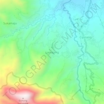
Name: Lamajang topographic map, elevation, terrain.
Location: Lamajang, Bandung, West Java, 40378, Indonesia (-7.14669 107.52299 -7.10669 107.56299)
Average elevation: 3,593 ft
Minimum elevation: 2,723 ft
Maximum elevation: 5,679 ft
Thank you for supporting this site ❤️
Make a donation
Make a donation
Gear up for your next adventure:
As an Amazon Associate, this site earns from qualifying purchases at no extra cost to you.
Other topographic maps
Click on a map to view its topography, its elevation and its terrain.
Sungai Cidurian (Babakan Surabaya)
Indonesia > West Java > Bandung > Bandung
Average elevation: 2,208 ft