
Make a donation
Gear up for your next adventure:
As an Amazon Associate, this site earns from qualifying purchases at no extra cost to you.
Lone Star topographic map
Click on the map to display elevation.
Make a donation
Gear up for your next adventure:
As an Amazon Associate, this site earns from qualifying purchases at no extra cost to you.
About this map
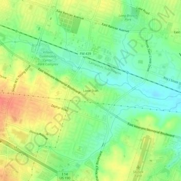
Name: Lone Star topographic map, elevation, terrain.
Location: Lone Star, Killeen, Bell County, Texas, 76543, United States (31.08295 -97.71891 31.12295 -97.67891)
Average elevation: 820 ft
Minimum elevation: 748 ft
Maximum elevation: 906 ft
Bell County trails, hiking, mountain biking, running and outdoor activities
Make a donation
Gear up for your next adventure:
As an Amazon Associate, this site earns from qualifying purchases at no extra cost to you.
Other topographic maps
Click on a map to view its topography, its elevation and its terrain.
La Quinta Inn Killeen - Fort Hood
United States > Texas > Bell County > Killeen
Average elevation: 889 ft