Geolocate

Corregidor topographic map

Click on the map to display elevation.

About this map

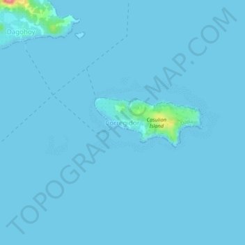
Name: Corregidor topographic map, elevation, terrain.

Location: Corregidor, Dapa, Surigao del Norte, Caraga, 8417, Philippines (9.67284 126.05742 9.71284 126.09742)

Average elevation: 7 ft

Minimum elevation: 0 ft

Maximum elevation: 322 ft

Gear up for your next adventure:

🦺Reflective Outdoor Gear - Safety gear for low‑light conditions
📷Action Cameras - Rugged cameras to document your journeys across rugged terrain
🕶️GPS Smartphone Mount - Secure mount for phone navigation
Backpacking Tent - Lightweight and durable tent for multi‑day hikes
🪶Camp Gear Gift Set - Perfect gift bundle for outdoor fans

As an Amazon Associate, this site earns from qualifying purchases at no extra cost to you.