
Thank you for supporting this site ❤️
Make a donation
Make a donation
Gear up for your next adventure:
As an Amazon Associate, this site earns from qualifying purchases at no extra cost to you.
Pisca topographic map
Click on the map to display elevation.
Thank you for supporting this site ❤️
Make a donation
Make a donation
Gear up for your next adventure:
As an Amazon Associate, this site earns from qualifying purchases at no extra cost to you.
About this map
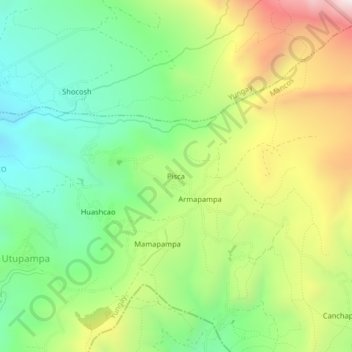
Name: Pisca topographic map, elevation, terrain.
Location: Pisca, Mancos, Yungay, Ancash, 02133, Peru (-9.20488 -77.66009 -9.16488 -77.62009)
Average elevation: 11,079 ft
Minimum elevation: 9,875 ft
Maximum elevation: 12,969 ft
Thank you for supporting this site ❤️
Make a donation
Make a donation
Gear up for your next adventure:
As an Amazon Associate, this site earns from qualifying purchases at no extra cost to you.