
Thank you for supporting this site ❤️
Make a donation
Make a donation
Gear up for your next adventure:
As an Amazon Associate, this site earns from qualifying purchases at no extra cost to you.
Beit Ula topographic map
Click on the map to display elevation.
Thank you for supporting this site ❤️
Make a donation
Make a donation
Gear up for your next adventure:
As an Amazon Associate, this site earns from qualifying purchases at no extra cost to you.
About this map
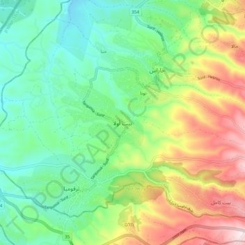
Name: Beit Ula topographic map, elevation, terrain.
Location: Beit Ula, Area B, West Bank, Palestinian Territory (31.55679 34.98849 31.63679 35.06849)
Average elevation: 1,900 ft
Minimum elevation: 1,204 ft
Maximum elevation: 3,192 ft
Thank you for supporting this site ❤️
Make a donation
Make a donation
Gear up for your next adventure:
As an Amazon Associate, this site earns from qualifying purchases at no extra cost to you.