Geolocate

Granger topographic map

Click on the map to display elevation.

About this map

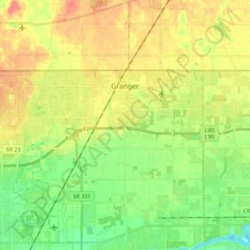
Name: Granger topographic map, elevation, terrain.

Location: Granger, Saint Joseph County, Indiana, United States (41.70957 -86.21754 41.76070 -86.06200)

Average elevation: 784 ft

Minimum elevation: 702 ft

Maximum elevation: 883 ft

Saint Joseph County trails, hiking, mountain biking, running and outdoor activities

Gear up for your next adventure:

🧣Hiking Neck Gaiter - Multi‑use neck protection for outdoor weather
🪶Thermal Camp Blanket - Extra warmth for cold nights
🕶️GPS Smartphone Mount - Secure mount for phone navigation
Solar GPS Watches - Advanced multisport watches with built-in topographic maps
🕶️Glacier Sunglasses - Side shields to protect eyes from high-altitude snow glare

As an Amazon Associate, this site earns from qualifying purchases at no extra cost to you.