
Thank you for supporting this site ❤️
Make a donation
Make a donation
Gear up for your next adventure:
As an Amazon Associate, this site earns from qualifying purchases at no extra cost to you.
Monte Torre Maggiore topographic map
Click on the map to display elevation.
Thank you for supporting this site ❤️
Make a donation
Make a donation
Gear up for your next adventure:
As an Amazon Associate, this site earns from qualifying purchases at no extra cost to you.
About this map
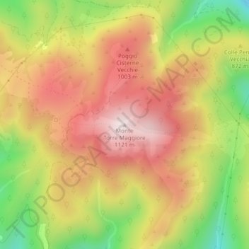
Name: Monte Torre Maggiore topographic map, elevation, terrain.
Location: Monte Torre Maggiore, Terni, Umbria, 05100, Italy (42.62840 12.60281 42.62850 12.60291)
Average elevation: 2,844 ft
Minimum elevation: 1,811 ft
Maximum elevation: 3,655 ft
Thank you for supporting this site ❤️
Make a donation
Make a donation
Gear up for your next adventure:
As an Amazon Associate, this site earns from qualifying purchases at no extra cost to you.