
Make a donation
Gear up for your next adventure:
As an Amazon Associate, this site earns from qualifying purchases at no extra cost to you.
Lower Austria topographic map
Click on the map to display elevation.
Make a donation
Gear up for your next adventure:
As an Amazon Associate, this site earns from qualifying purchases at no extra cost to you.
About this map
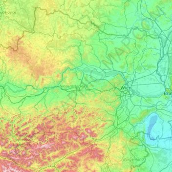
Name: Lower Austria topographic map, elevation, terrain.
Location: Lower Austria, Austria (47.42221 14.45264 49.02052 17.06884)
Average elevation: 1,634 ft
Minimum elevation: 361 ft
Maximum elevation: 7,808 ft
Make a donation
Gear up for your next adventure:
As an Amazon Associate, this site earns from qualifying purchases at no extra cost to you.
Other topographic maps
Click on a map to view its topography, its elevation and its terrain.
Make a donation
Gear up for your next adventure:
As an Amazon Associate, this site earns from qualifying purchases at no extra cost to you.
Zöbing an der Raab
Austria > Styria > Bezirk Weiz > St. Margarethen an der Raab
Average elevation: 1,155 ft