Geolocate

Polesio topographic map

Click on the map to display elevation.

About this map

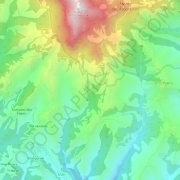
Name: Polesio topographic map, elevation, terrain.

Location: Polesio, Ascoli Piceno, Marche, 63071, Italia (42.88495 13.53896 42.92495 13.57896)

Average elevation: 1,650 ft

Minimum elevation: 676 ft

Maximum elevation: 3,543 ft

Other topographic maps

Click on a map to view its topography, its elevation and its terrain.

Montagna dei Fiori

Italia > Marche > Ascoli Piceno > Ascoli Piceno

Average elevation: 2,323 ft

Gear up for your next adventure:

🛶Inflatable Kayak - Portable kayak for rivers, lakes, and expeditions
🔊Portable Camp Speaker - Music and alerts at camp
🔋Solar Power Banks - Keep your GPS and phone charged in remote wilderness areas
🦟Ultrasonic Repellers - Create a bug-free zone at your camp or rest stop
📱Solar Portable Charger - Solar power bank for charging devices off‑grid

As an Amazon Associate, this site earns from qualifying purchases at no extra cost to you.