Geolocate

Rincón topographic map

Click on the map to display elevation.

About this map

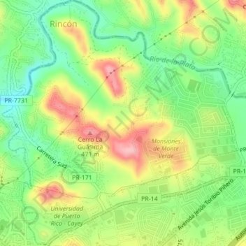
Name: Rincón topographic map, elevation, terrain.

Location: Rincón, Cayey, Puerto Rico, 00737, United States (18.11414 -66.16977 18.14663 -66.13715)

Average elevation: 1,289 ft

Minimum elevation: 1,083 ft

Maximum elevation: 1,549 ft

Puerto Rico trails, hiking, mountain biking, running and outdoor activities

Other topographic maps

Click on a map to view its topography, its elevation and its terrain.

La Piedra

United States > Puerto Rico > Cayey

Average elevation: 1,923 ft

Gear up for your next adventure:

🦺Reflective Outdoor Gear - Safety gear for low‑light conditions
🛠️Backpacking Tool Kit - Essential toolkit for outdoor repairs
🌡️Handheld Weather Meters - Measure wind, temp, and pressure for safe mountain travel
🔌Solar Panel Charger - Charge gear sustainably outdoors
🔦Powerful Headlamps - Ultra-bright hands-free lighting for night navigation

As an Amazon Associate, this site earns from qualifying purchases at no extra cost to you.