Geolocate

Nanno topographic map

Click on the map to display elevation.

About this map

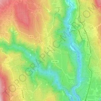
Name: Nanno topographic map, elevation, terrain.

Location: Nanno, Ville d'Anaunia, Comunità della Val di Non, Provincia di Trento, Trentino-Alto Adige/Südtirol, 38093, Italy (46.29448 11.02803 46.33448 11.06803)

Average elevation: 1,752 ft

Minimum elevation: 1,129 ft

Maximum elevation: 2,510 ft

Other topographic maps

Click on a map to view its topography, its elevation and its terrain.

Gear up for your next adventure:

🎒Day Hiking Backpack - Lightweight backpack perfect for day trips and outdoor adventures
🪶Trail Camera - Capture wildlife on your hikes
🧯Portable Fire Pit - Compact fire pit for camping spots
🥘Titanium Cookware - Durable, featherlight pots and pans for backpacking
🪶Survival Guide Book - Expert advice for emergency preparedness

As an Amazon Associate, this site earns from qualifying purchases at no extra cost to you.