
Thank you for supporting this site ❤️
Make a donation
Make a donation
Gear up for your next adventure:
As an Amazon Associate, this site earns from qualifying purchases at no extra cost to you.
Makhoabeng topographic map
Click on the map to display elevation.
Thank you for supporting this site ❤️
Make a donation
Make a donation
Gear up for your next adventure:
As an Amazon Associate, this site earns from qualifying purchases at no extra cost to you.
About this map
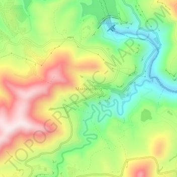
Name: Makhoabeng topographic map, elevation, terrain.
Location: Makhoabeng, Thaba-Tseka District, 333, Lesotho (-29.37308 28.48153 -29.33308 28.52153)
Average elevation: 7,064 ft
Minimum elevation: 6,198 ft
Maximum elevation: 8,140 ft
Thank you for supporting this site ❤️
Make a donation
Make a donation
Gear up for your next adventure:
As an Amazon Associate, this site earns from qualifying purchases at no extra cost to you.