Geolocate

Andalusia topographic map

Click on the map to display elevation.

About this map

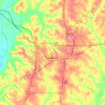
Name: Andalusia topographic map, elevation, terrain.

Location: Andalusia, Covington County, Alabama, United States (31.27710 -86.52253 31.34839 -86.41788)

Average elevation: 282 ft

Minimum elevation: 118 ft

Maximum elevation: 394 ft

Covington County trails, hiking, mountain biking, running and outdoor activities

Other topographic maps

Click on a map to view its topography, its elevation and its terrain.

River Falls

United States > Alabama > Covington County

Average elevation: 220 ft

Gear up for your next adventure:

🌎3D Topographic Globes - Raised relief globes for a tactile understanding of geography
🕶️Glacier Sunglasses - Side shields to protect eyes from high-altitude snow glare
🛠️Backpacking Tool Kit - Essential toolkit for outdoor repairs
🎒Gear Packing Cubes - Organize your backpack efficiently
🎒Outdoor Daypacks - Lightweight backpacks designed for carrying maps and essential gear

As an Amazon Associate, this site earns from qualifying purchases at no extra cost to you.