Geolocate

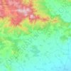
Belashtitsa topographic map

Click on the map to display elevation.

About this map

Name: Belashtitsa topographic map, elevation, terrain.

Location: Belashtitsa, Rodopi, Plovdiv, 4124, Bulgaria (42.04580 24.72559 42.08580 24.76559)

Average elevation: 935 ft

Minimum elevation: 561 ft

Maximum elevation: 2,467 ft

Other topographic maps

Click on a map to view its topography, its elevation and its terrain.
Централен

Bulgaria > Plovdiv > Plovdiv

Average elevation: 551 ft

Hisaria

Bulgaria > Plovdiv

Average elevation: 1,719 ft

Западен

Bulgaria > Plovdiv > Plovdiv

Average elevation: 564 ft

Южен

Bulgaria > Plovdiv

Average elevation: 568 ft

Централен

Bulgaria > Plovdiv

Average elevation: 551 ft

Hisaria

Bulgaria > Plovdiv

Average elevation: 1,719 ft

Източен

Bulgaria > Plovdiv

Average elevation: 522 ft

Южен

Bulgaria > Plovdiv

Average elevation: 568 ft

Gear up for your next adventure:

💧Water Purification System - Clean water on the trail with reliable purifiers
🧦Merino Wool Socks - Moisture-wicking, blister-preventing socks for long treks
🪵Folding Camp Saw - Compact saw for wood and campsite work
🧯Emergency Survival Kit - All‑in‑one survival essentials for the backcountry
🚪Portable Camp Chair - Foldable chair for comfort at camp

As an Amazon Associate, this site earns from qualifying purchases at no extra cost to you.