
Thank you for supporting this site ❤️
Make a donation
Make a donation
Gear up for your next adventure:
As an Amazon Associate, this site earns from qualifying purchases at no extra cost to you.
Salar topographic map
Click on the map to display elevation.
Thank you for supporting this site ❤️
Make a donation
Make a donation
Gear up for your next adventure:
As an Amazon Associate, this site earns from qualifying purchases at no extra cost to you.
About this map
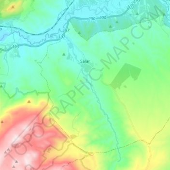
Name: Salar topographic map, elevation, terrain.
Location: Salar, Comarca de Loja, Grenade, Andalousie, 18310, Espagne (37.08993 -4.10668 37.18306 -3.96613)
Average elevation: 2,418 ft
Minimum elevation: 1,476 ft
Maximum elevation: 4,856 ft
Thank you for supporting this site ❤️
Make a donation
Make a donation
Gear up for your next adventure:
As an Amazon Associate, this site earns from qualifying purchases at no extra cost to you.