
Chandurbazar topographic map
Interactive map
Click on the map to display elevation.
About this map
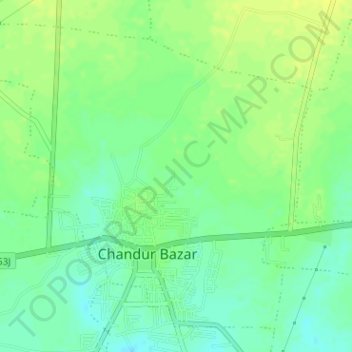
Name: Chandurbazar topographic map, elevation, terrain.
Location: Chandurbazar, Amravati, Maharashtra, India (21.23124 77.73108 21.25686 77.76278)
Average elevation: 1,234 ft
Minimum elevation: 1,201 ft
Maximum elevation: 1,260 ft
Other topographic maps
Click on a map to view its topography, its elevation and its terrain.
Boraj
India > Maharashtra > Chandurbazar
Boraj, Chandurbazar, Amravati, Maharashtra, India
Average elevation: 1,253 ft
Pandhari
India > Maharashtra > Chandurbazar
Pandhari, Chandurbazar, Amravati, Maharashtra, India
Average elevation: 1,302 ft