
Make a donation
Gear up for your next adventure:
As an Amazon Associate, this site earns from qualifying purchases at no extra cost to you.
North District topographic map
Click on the map to display elevation.
Make a donation
Gear up for your next adventure:
As an Amazon Associate, this site earns from qualifying purchases at no extra cost to you.
About this map
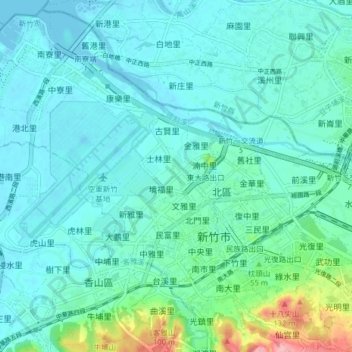
Name: North District topographic map, elevation, terrain.
Location: North District, Taiwan Province, Taiwan (24.78179 120.91129 24.85321 120.99064)
Average elevation: 75 ft
Minimum elevation: -10 ft
Maximum elevation: 436 ft
Make a donation
Gear up for your next adventure:
As an Amazon Associate, this site earns from qualifying purchases at no extra cost to you.
Other topographic maps
Click on a map to view its topography, its elevation and its terrain.
Songbailun
Taiwan > Taiwan Province > Nantou County > Yuchi Township > Songbailun
Average elevation: 2,533 ft
Make a donation
Gear up for your next adventure:
As an Amazon Associate, this site earns from qualifying purchases at no extra cost to you.