
Thank you for supporting this site ❤️
Make a donation
Make a donation
Gear up for your next adventure:
As an Amazon Associate, this site earns from qualifying purchases at no extra cost to you.
Corazón topographic map
Click on the map to display elevation.
Thank you for supporting this site ❤️
Make a donation
Make a donation
Gear up for your next adventure:
As an Amazon Associate, this site earns from qualifying purchases at no extra cost to you.
About this map
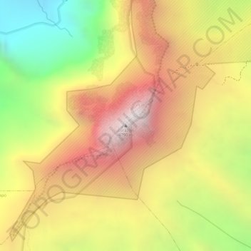
Name: Corazón topographic map, elevation, terrain.
Location: Corazón, Aloasí, Machachi, Pichincha, Ecuador (-0.53201 -78.66055 -0.53191 -78.66045)
Average elevation: 13,842 ft
Minimum elevation: 11,470 ft
Maximum elevation: 15,679 ft
Thank you for supporting this site ❤️
Make a donation
Make a donation
Gear up for your next adventure:
As an Amazon Associate, this site earns from qualifying purchases at no extra cost to you.