Geolocate

Sunderland topographic map

Click on the map to display elevation.

About this map

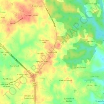
Name: Sunderland topographic map, elevation, terrain.

Location: Sunderland, Calvert County, Maryland, 21689, United States (38.65123 -76.61801 38.69123 -76.57801)

Average elevation: 115 ft

Minimum elevation: 16 ft

Maximum elevation: 197 ft

Calvert County trails, hiking, mountain biking, running and outdoor activities

Gear up for your next adventure:

🪶Camping Sleeping Pad - Comfortable sleeping pad for backpacking
🧥Men's Rain Shells - Premium waterproof and breathable jackets for mountain weather
🎒Gear Packing Cubes - Organize your backpack efficiently
📚Navigation Handbooks - Master the art of reading topographic maps and using a compass
🪶LED Camping Lantern - Bright lantern for camp lighting

As an Amazon Associate, this site earns from qualifying purchases at no extra cost to you.