
Make a donation
Gear up for your next adventure:
As an Amazon Associate, this site earns from qualifying purchases at no extra cost to you.
Sint-Amandsberg topographic map
Click on the map to display elevation.
Make a donation
Gear up for your next adventure:
As an Amazon Associate, this site earns from qualifying purchases at no extra cost to you.
About this map
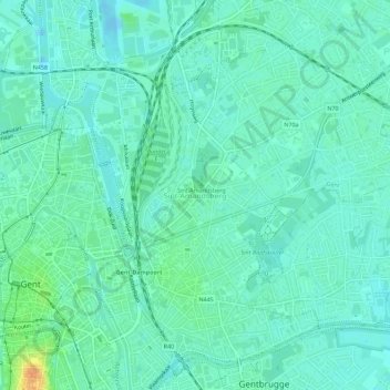
Name: Sint-Amandsberg topographic map, elevation, terrain.
Location: Sint-Amandsberg, Gent, Oost-Vlaanderen, Vlaanderen, 9040, België (51.04640 3.74327 51.07740 3.79977)
Average elevation: 26 ft
Minimum elevation: -26 ft
Maximum elevation: 108 ft
Make a donation
Gear up for your next adventure:
As an Amazon Associate, this site earns from qualifying purchases at no extra cost to you.
Other topographic maps
Click on a map to view its topography, its elevation and its terrain.
Make a donation
Gear up for your next adventure:
As an Amazon Associate, this site earns from qualifying purchases at no extra cost to you.
Bourgoyen-Ossemeersen
België > Oost-Vlaanderen > Gent > Gent > Mariakerke
Zoals de naam aangeeft, bestaat dit reservaat uit twee domeinen, de Bourgoyen enerzijds in het noorden en de Ossemeersen anderzijds in het zuiden. Het noordelijke deel wordt reeds vermeld in documenten van de 14de eeuw, alwaar het de benaming Bergoye heeft, wat etymologisch gezien uit twee onderdelen bestaat:…
Average elevation: 23 ft
Nationale Watersportbaan Georges Nachez
België > Oost-Vlaanderen > Gent > Gent
Average elevation: 23 ft
Make a donation
Gear up for your next adventure:
As an Amazon Associate, this site earns from qualifying purchases at no extra cost to you.